Posts Tagged ‘Coal Creek open space preserve’

Arachnids rule!

September 18, 2016

Saturday, 17 September 2016

Five of us cleared three areas of Fremont Older open space preserve of stinkwort, all of it that we could find. The day was bright and sunny, but started out cool and gray, with wonderful condensation patterns on the cobwebs and indeed, on their proprietors.

img_3657

img_3663

Garden spider season, and no mistake.

Sunday, 18 September

Speaking of which, it’s also getting on into the time of year when the tarantulas come out. Do you suppose, if I go trail patrolling in the open grasslands, I’ll find one? So I drove up Page Mill road and hiked a loop through Montebello, Coal Creek, Russian Ridge and Skyline Ridge open space preserves.

img_3667

No tarantuli, but I did find two gopher snakes and a garter snake. That’s three-up from the usual count.

img_3671

img_3677

img_3709

img_3703

Only recently did I learn that the forked tongue is actually a stereo sensor, able to differentiate the taste of the air left to right and help the snake locate smelly things such as, well, me.

A spare the air day here, not much breeze, highs estimated at 90 in San Jose, 100 in Livermore. Maybe a bit cooler on the ridge over the ocean, but still a hot day. Glad I have water.

A week ago, Ellen, Tom and I scoured Mindego Hill for purple star thistle. It was part of my hiking plan anyway, so I took along a trash bag and scoured it a second time. If we got 90% of it last week, and I got 90% of what was left today, we’re down to 1% remainders. Hard to estimate these numbers, of course, but I think they’re not too far off.

This left me with a trash bag to carry out. I tied it to the back of my backpack, where it probably looked silly, but didn’t get in my way. Dropped it off at the Midpen Skyline Field Office (always known, confusingly, as SFO), where I talked with Ranger Frances for a few minutes.

I used up all of my water before I got there, but I was able to tank up again at Alpine Pond. A life-saver, and no mistake. Too bad there are so few sources of drinking water up there, but that’s how it is.

As to big spiders, the season is yet young, and I’ll be out there looking for them next week, and the next and the next.

Good days to be outdoors

June 12, 2016

Sunday, 12 July 2016

When she has no formal projects planned, volunteer coordinator Ellen is available for ad hoc projects. We met on Saturday to work on broom along Razorback Ridge trail at Windy Hill. Pleasant day, and we made a dent, but there is so much that it was only a dent. It will need to be sprayed next season.

IMG_0737

I talk a lot about broom. Here’s a broom in bloom. This one is Spanish broom, rather than the more common French, and far more difficult to uproot. This one is above Horseshoe lake, a reminder to someone with a big weed wrench some day. Or maybe a pickaxe.

I was on the trail by 7 Sunday morning, up through Los Trancos, Montebello, Coal Creek, Russian Ridge and Skyline Ridge preserves. Pleasantly cool in the breeze, nice day. I should have gone to Mindego summit, but I wasn’t sure how much I had committed myself to, so I skipped it today. Next time: it turned out to be less than 16 miles, even with several little extra side excursions.

One of the side excursions was around Fir Knoll at Skyline Ridge. This is a trail that adds an extra 0.6 miles with no utilitarian purpose whatever; its only justification for existence is that it runs through a very pretty forest. Well, what more could we ask!

IMG_0700

And Ellen told me yesterday that there were still wildflowers on the walk around Horseshoe Lake. There are still wildflowers everywhere, but that’s a route I rarely take, so it was a good opportunity.

IMG_0708

I don’t think I had previously noticed the wild columbine turning up their sex organs for all to enjoy!

IMG_0714

IMG_0722

Flowers are to enjoy, right? Small animals in just about every one, enjoying.

IMG_0727

Well, maybe not this one. It’s about a sixteenth of an inch across.

IMG_0736

IMG_0891

IMG_0900

IMG_0902

To those who know better: yes, some of these pictures came from later, but I put them in pictorial order here.

IMG_0774

The eye spots on the dragonfly make it look as if it has a real face.

IMG_0699

And I presume the presence of the nymph is purely coincidental, nothing to do with the adult’s presence. I continue to boggle at the fact that the leading edges of their wings are open.

IMG_0778

IMG_0792

Ellen said there was larkspur on the Horseshoe lake circuit, one of the reasons I wanted to do it. Maybe what she said, or what she meant, was: there is even a light smattering of larkspur. Certainly nothing like a rich growth.

IMG_0820

I never noticed these little guys before. Tom tells me it’s Fitches spikeweed, and pretty unusual around here.

IMG_0822

I like its compound flowers.

IMG_0755

Well, I mentioned earlier that every flower has its small animals, not all of which are vegetarian. The Mariposa lilies are especially rich in photo ops. Above, we see a spider that has caught a little bee of some sort, while meanwhile, lunch goes on across the way. (Side comment: I think there are far more Mariposa lilies this year than usual, especially in comparison with California poppies.)

IMG_0881

Here’s a hungry spider, and below a good-sized carnivorous insect.

IMG_0751

IMG_0856

Saving the best for last, I was delighted with this picture. No sooner do you start eating lunch than you find that you are lunch!

Yet another busy weekend

May 3, 2015

Saturday, 2 May 2015

I had originally signed up for a trail-building volunteer project, but my tennis elbow suggests I should take it easy for a week or three, so I begged off. Instead, I thought I’d park at Palo Alto Foothills park and do a serious hike from there, but the gate was still closed when I arrived, so I went on up the hill as far as the first gate into Los Trancos, and improvised a hike that turned out not to be as long as I had intended (16.5 miles, 2800 vertical feet). Nice day, and the wildflowers are out everywhere.

P1180010

I stopped at the Stevens Creek crossing along Canyon trail to photograph the underwater newts (three in this picture).

P1180019

Many hours later, I entered Coal Creek preserve on my way back toward the car. Given that I am pretty sure I saw a mountain lion at Coal Creek a few weeks ago, I wouldn’t want to sell life insurance on that cow.

Wildlife: as well as the newts, a garter snake. Nice.

Sunday, 3 May

Given that yesterday was less than what I wanted to do, I filled in today by visiting the rest of the trail junctions in El Corte de Madera open space preserve. This is part of my trail signs audit project, which I am going to have to sell to the district.

P1180043

The overnight fog was just lifting. Very nice.

P1180039

Tafoni is a kind of sandstone, subject to interesting letterboxing, and one of the attractions of this preserve. There is more tafoni around here, for example at Bean Hollow state beach, but not as close and convenient.

P1180041

In 1953, a DC6 crashed in the fog on this ridge. This was still during the time when aircraft had names, and this one was the Resolution. So the trail that runs past the site is the Resolution trail. I doubt they had the equivalent of ATVs to help with salvage, and there may or may not have even been a trail along there. Likely as not, whatever was recovered was carried out on horses or mules.

After recovering the bodies and personal effects, the next priority would have been forensic evidence. Then whatever small things might have been of value would have been salvaged, for example instruments or computers. Things that were too big or too heavy to justify removal would have been left behind, where they have probably been picked over by souvenir hunters for sixty years.

P1180051

I haven’t come along this trail for a few months, and don’t recall that there was much of anything to see. Today, there was all kinds of aircraft debris along the trail, more visible down the hill below the trail. Surprising, in a way, that there still remains this much that’s both interesting and movable.

P1180054

My guess that that scavengers have been prowling around down there, and for whatever reason, just didn’t have a chance to haul away the latest set of goodies.

Hours later, I had been down to the further reaches of the preserve and was on the way out, having talked to a number of mountain bikies, found a rotten plank in a bridge for my trail report, and generally had a good time (14 miles, 3300 vertical feet). The fog had blown in off the ocean and it was chilly and windy.

A group of hikers came past, and the red madrone tunnel suggested a perfect photo. (And yes, they agreed. But I shot them before they were all posed.)

P1180099

Mellow

January 2, 2015

Friday, 2 January 2015

Yesterday I went to Purisima open space preserve and put in five hours searching and destroying broom. Also exploring one or two informal trails and ancient logging roads. Today, I hiked what might be thought of as the four corners, the open space preserves surrounding Page Mill and Skyline roads.

I didn’t want to do a killer hike today, because I’m meeting a friend tomorrow to visit Grant Ranch. Still, I ought to make the hike long enough to justify driving up the hill. So I decorated the basic loop with a few extras (14 miles, 2000 vertical feet). For example, there is a closed gate where the official trail ends at Alder Springs, in Russian Ridge, but the trail goes on, and there is no Keep Out sign. New country for me, down the Mindego creek watershed to a point above some private homes where it really is a closed area.

P1160802

Along Hawk ridge trail, a really beautiful rock.

P1160804

Cold this morning — crunchy mud, better than squidgy mud — but I was down to shirtsleeves (two layers!) by late morning. There was no commitment to wonderful weather over the holidays, but that is certainly how it has turned out.

P1160809

This is the redwood railing over the bridge that spans Lambert creek, the drainage from Horseshoe lake in Skyline ridge preserve. Nice to look at, but I wouldn’t run my hand along there!

P1160810

More decorations of the basic hike: a detour down Lambert creek trail as far as a fallen tree, which wasn’t worth my time trying to work around. Then there was the official Bay trail, which goes over Fir Knoll, despite the availability of a 90% shortcut. But the Fir Knoll trail is really pretty, and the right thing to do.

Back in Montebello, several fallen trees to report for a visit by the chainsaw crew. None of them were problems, and when I met a couple with a stroller, I didn’t see any reason to warn them about fallen trees: they would need to lift the stroller over, but it wouldn’t be the slightest problem. The woman greeted me, “Another perfect day in paradise.” Right.

I had almost used up the plastic tape with which I flag fallen trees, so I stopped at the open space district office in Mountain View when I got down the hill. They had been open today, but had closed at 2. Fortunately, someone was still around, and gave me enough tape to keep me going for a while. Then I stopped at REI to indulge my hobby of acquiring trail maps, and called it a day.

YST and Coal Creek

July 26, 2014

Saturday, 26 July 2014

It was supposed to be a very hot day, so I set the alarm an hour early. Arrived at a side gate of Los Trancos just after 6, and spent 3 1/2 hours attacking yellow star thistle. Hard to get my work gloves on, especially the right hand, because it’s swollen and puffy from last week’s poison oak.

Dumped my bucket of spoils at the tarp-covered compost heap. The way this works is that the flower heads will continue to develop seed even after they are plucked, so they can’t be left where they lie. To keep them from germinating, the compost heap is covered with an open mesh dark green plastic tarp. Mice and voles love to eat the fluffy seed as it develops, which is fine. A high population density of mice and voles attracts rattlesnakes, which is also fine, except that, when you’re popping the top off the compost heap, it’s advisable to be prepared. Being prepared: I had my camera turned on, lens cap off, ready to go, but there was no snake for me.

Having finished the hard work for the day, I went off on trail patrol. Cut across the top of Montebello open space preserve, toward Alpine road, with a detour down to the little pond here.

P1150618

Just below the pond, a garter snake. Cool!

Today’s objective is to hike all of the trails in the Coal Creek open space preserve. The main trail here is old Alpine road, which was a complete road up-and-down, albeit unpaved, when I first started mountain biking these hills, lo those many years ago. One wet winter, the road collapsed, and because it was just a fire road, not the essential access to anyone’s home, there was no way to justify the expense of repairing it. So they built a mountain bike trail around the washout, and there it has remained ever since.

I hadn’t realized it, but the trail, and the old road, descend all the way into Portola Valley before finally crossing the boundary out of the Coal Creek preserve. I had taken extra water, to replace the water I had consumed during my thistle-pulling hours, but didn’t have enough for that much additional work.

Reluctantly, I returned to the car, having hiked only old Alpine road, none of the side trails. Drove to Alpine pond, where there is a supply of drinking water, and tanked up, two bottles and the belly. While I was there, I went down to the pond to see if anything interesting was posing for photographs.

P1150673

Interesting, indeed. I always like these little guys. How many insects have necks?

P1150645

P1150624

And how many airfoils are open on the leading edge?

Drove to the Russian Ridge Vista Point on Skyline, whence I hiked the remaining trails at Coal Creek. One of the trails is old Coal Road, which does in fact go past a black embankment, but the black really just looks like mudstone. If it’s indeed coal, I bet it’s pretty low grade. The most interesting name, of course, is Crazy Pete’s road, which is a trail. It runs into Crazy Pete’s trail, which is a road. Crazy!

A really seriously hot day, and my ass was dragging by the time I finished, ten hours after the morning’s events had started. I count it as a killer hike, even though it turned out to be only 17 miles, 2800 vertical feet.

Home to plunge the swollen arms into ice water — which didn’t help much, if at all. Well past the time when I ought to be developing an immunity to poison oak, but it doesn’t seem to be happening.

Signs of spring?

February 23, 2013

Saturday, 23 February, 2013

Last time I did more or less this hike, I parked at Arastradero Preserve, and hiked uphill from there. That hike was upward of 21 miles, and I didn’t have time or stamina to complete a loop at the top, just went out to Horseshoe lake and back. Today, I parked a little further up the hill, at Foothills park, and stitched together trails through Foothills, Los Trancos Open Space Preserve, Montebello OSP, Coal Creek OSP, Russian Ridge OSP, Long Ridge OSP, and back through Montebello, Los Trancos and Foothills park. It was an industrial strength hike (17 miles, 3300 vertical feet) but not a killer hike.

It was a sunny day, cold in the shade, cold in the wind, warm in the sun. Nice.

As I hiked up Los Trancos trail in Foothills park, I met another hiker who asked me whether there was another trail off to the left, a trail that would take him back down. The Los Trancos trail swings around to the right for a good-sized loop, but left? Hmmm… In the absence of guidance, the other hiker turned back and went back down on Los Trancos trail.

Two minutes later, I came to the Castanoan trail turnoff, leading down and to the left. Now that I see it, I remember that it was there. I have never taken that trail; maybe I’ll do it on the return trip as a way to remember it next time.

P1150493

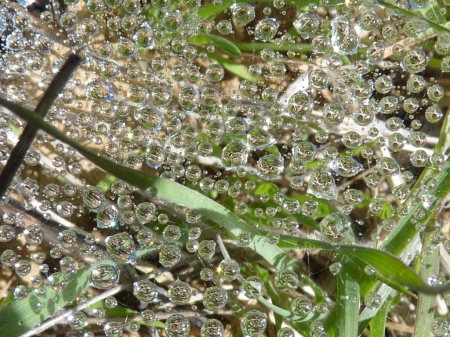
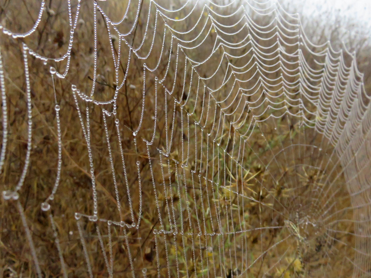
A spider web, with dew that would likely last all day, even in the sun.

From Montebello, the route went down old east Alpine road. This was the only really muddy and gunky part of the hike, mostly because it’s in the shade and graded below the adjacent hill. When I first started riding and hiking the bay area, east Alpine was a real road, that ran all the way from Portola Valley to Skyline. Unpaved and closed to cars even then, but for a mountain bikie, it was a fire road ride, not a single-track trail ride. Many years ago, part of the road collapsed in a landslide, and as a secondary road, it just wasn’t worth repairing. So they built a mountain bike trail around the landslide… today, I notice on the map a note that the route is completely impassible. Not clear whether the note refers only to the road part — that’s not new news — or also to the mountain bike trail.

In any event, I turned back uphill before reaching Crazy Pete’s road — there’s a name I like! — and crossed Skyline near the vista point into the Russian Ridge OSP. Sunny up here on the ridge, but cold in the wind.

P1150494

From Russian Ridge OSP, the trail crosses under west Alpine road into Long Ridge OSP and Alpine pond. I stopped there to soak up calories and enjoy the day. On the bulletin board, I notice that there will be a Signs of Spring event here tomorrow. Well, it’s true that the predominant colour is green, but in the bay area, that is more a sign of winter than a sign of spring. Wildflowers? Arthropodae? Not many.

P1150499

Having been primed to look for signs of spring, I kept a close eye out as I went back down the hill. Yes, there are a few wildflowers, but not many types and not very prolific. You have to look carefully for them.

P1150504

P1150505

P1150507

I like the 2×5 pattern of the petals on these microscopic blossoms.

P1150515

I turned off on Castanoan trail, as I had promised myself. It dropped me out at the top of Wild Horse valley, as I had also recalled. From there, it was a simple walk half a mile back to the car.

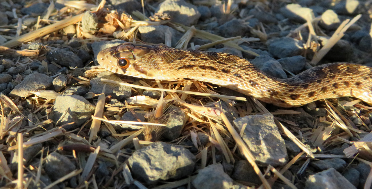
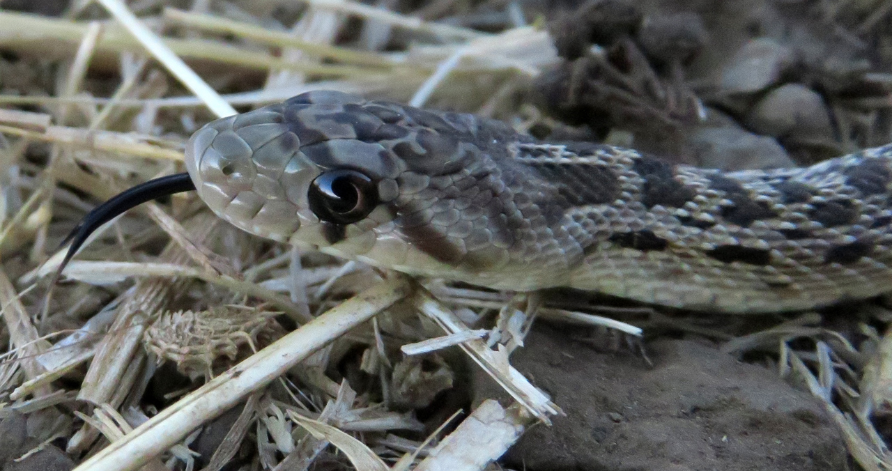
Today’s adventure: this is where I came upon a gent lying on the semi-paved trail. When I got closer, I saw that he had a camera, so I went over to see what he was doing. He had a sheet of soft white plastic and a shaker of forest duff. What he would do is shake a loose scattering of duff onto the plastic sheet, inspect it for small animals and then photograph them. My kind of guy!

P1150517

Of course, he had a real camera, with two radio-activated flashes and the whole bit. I can hardly compete… but even so, this looks like a really good idea. I think I will experiment with it myself.

As to the signs of spring, yes, they exist if you look for them, especially down a few hundred feet and inland a few miles from Long Ridge OSP. But unless something really dramatic happens overnight, anyone who drives to Long Ridge tomorrow hoping to see meadows chock full of wildflowers and arthropodae is likely to be a bit disappointed.