Saturday, 24 August 2013
The Mid-Peninsula Open Space District had its annual volunteer appreciation fest today. Jacky and I drove to Montebello open space preserve, where there was a considerably larger than expected crowd of volunteers and staff. There were two ranger-led hikes; we went on the Los Trancos hike, a little over 3 miles. Then we stopped at the food wagons, where Jacky restrained herself to one entree. I also had one entree, one, that is, from each of the three food wagons. Plus, for both of us, a stop at the ice cream truck.
Sunday, 25 August
Grant Ranch today. I haven’t been here for a while, and the temperature is predicted to be only in the low 80s, so it shouldn’t be too bad. I parked at my usual spot, on Mt Hamilton road near the old barn on the Washburn road trail.

Nice to see wildflowers, even this late in the season, some of them really pretty.


The trail descends to cross a creek, dry at this time of year, then cilmbs out the other side. As a vague general rule, when you see mostly blue sky beyond the trail horizon, you can conclude that you’re getting close to the top.

We go around the curve. Are we there yet? No, but I bet that’s the top!

We go around the curve. Are we there yet? No, but I bet that’s the top!

We go around the curve. Are we there yet? No, but I bet that’s the top!

We go around the curve. Are we there yet? No, but I bet that’s the top!

We go around the curve. Are we there yet? No, but I bet that’s the top!

We go around the curve. Are we there yet? No, but I bet that’s the top!

We go around the curve. Are we there yet? No, but I bet that’s the top!

We go around the curve. Are we there yet? No, but I bet that’s the top!

We go around the curve. Are we there yet? No, but I bet that’s the top!

We go around the curve. Are we there yet? No, but I bet that’s the top!

We go around the curve. Are we there yet? No, but I bet that’s the top!

We go around the curve. Are we there yet? No, but I bet that’s the top!

We go around the curve. Are we there yet? No, but I bet that’s the top!

That post marks the junction with Tamien trail, so yes, we really are just about there.

The view from the Tamien trail junction, looking down at the old barn, my car a white dot at the far right of the expanded picture below.


We go around the curve. Are we there yet?

All right, all right, enough of this. Yes, we are there. Nothing but down in all directions. 1500 feet of gain in about 2 miles. Drenched with sweat, even though it’s still the coolth of the morning.
Even though I have done this many times, I still succumb to the fond illusion that I’m almost there.
Down the other side, nowhere near as far down as it was up, into the valley of the Pala Seca cabin. When I first began hiking Grant Ranch, it was shown on the trail map as the Line Shack. But then they discovered that President Theodore Roosevelt used to use it as a hunting lodge, so they fixed it up a little and dressed up its name.

A herd of maybe 20 wild pigs running along the hill above me, then across the trail and down the other side. Glad they’re afraid of humans; if they wanted to, they could easily kill me and eat me. Really! The most dangerous things in the park. Let’s hope they never get smart.

From the back steps of the Pala Seca cabin, where I stopped for calories, a view of downtown San Jose. I don’t think I had ever noticed that particular view before; it’s a clear day.

Doris, what flavour woodpecker are these? (Acorn woodpecker, she says.)
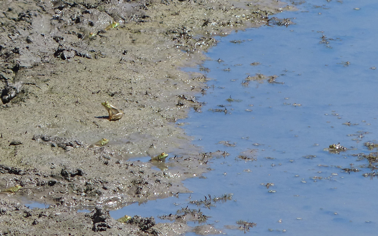
Many hours later, after having met two hikers, the only two of the day, and two mountain bikies, the only two of the day, I stopped again for calories, overlooking a small pond with a drastically subsided shoreline. Frogs, frogs everywhere. This picture shows at least 7, and that’s just on the mud.

Even though it’s not all that hot, it seems muggy. Clouds building up, and we see that a flying saucer has attacked Lick Observatory, which will never again be so foolish as to report little green men on Alpha Centaurus.
Muggy it was. Using more water than I expected, so I shortened the course a little, down to about 19 miles and 3600 feet of climb. Even so, the water bottle was reading E when I got back to the car.