Archive for July, 2016

Kirkwood

July 27, 2016

Wednesday, 27 July 2016

Up, eat, out. A moderate drive today, to Kirkwood Mountain Resort, where we hope to enjoy the shade of high-altitude forest, even if it’s hot.

IMG_3150

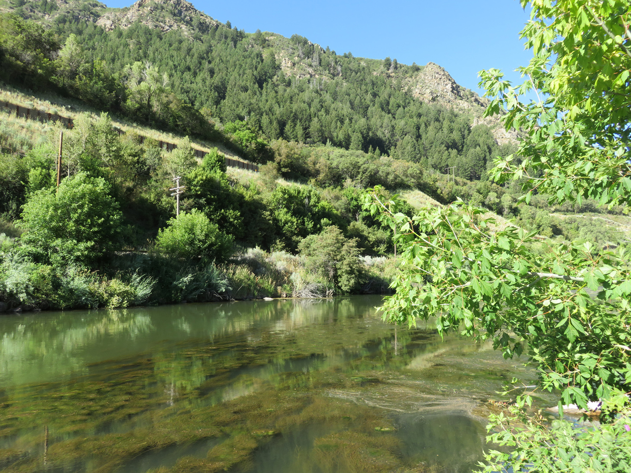
The first stop of any significance was at Carson Pass. After the salt desert of Utah and the basin and range of Nevada, it’s wonderful to be back in the Sierra Nevada.

IMG_3155

I talked to the bikie. He said he lives in South Tahoe, just decided to come out and ride today. Thought he’d go as far as Kirkwood, then turn around and go back. Good for him!

IMG_3162

We too found ourselves at Kirkwood not much later. We’ve gone past here any number of times, but never turned in. It’s actually quite a big place, condos and lodges, surrounded by a U of volcanic cliffs, with ski lifts going up in all directions. These places are trying to turn themselves into four-season attractions, but I think Kirkwood is falling short. Few people here, trails almost deserted, lots of empty parking places, For-Sale signs everywhere. Only food in walking distance is at the general store, which closes at 5.

While we wish them all success, we’re happy to have the world more or less to ourselves. Jacky and I went out for a hike, along the Dangberg trail.

IMG_3169

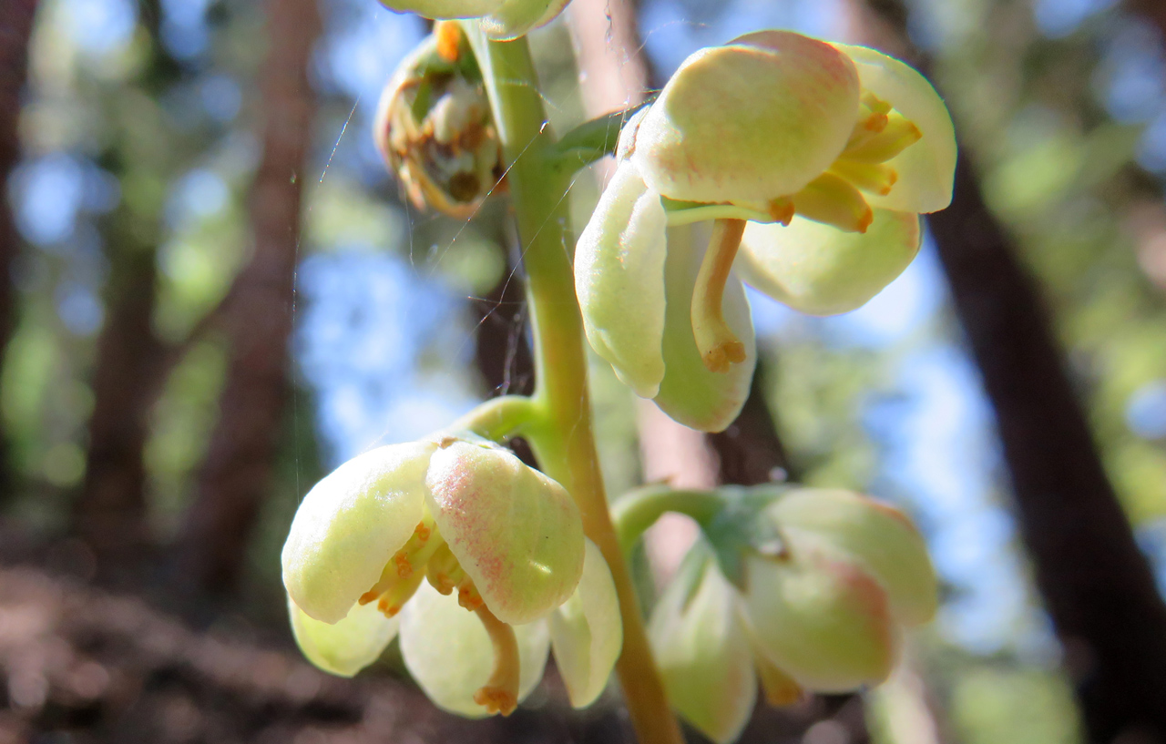
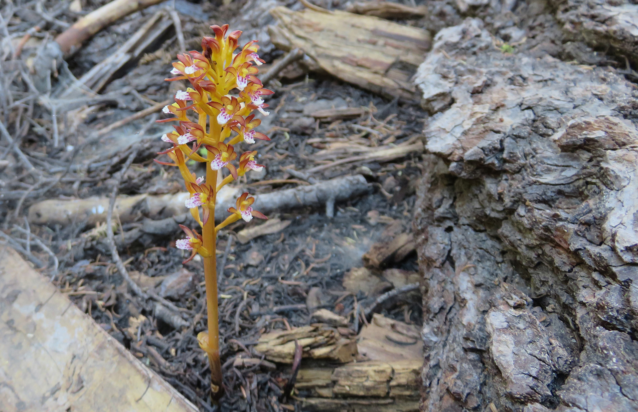
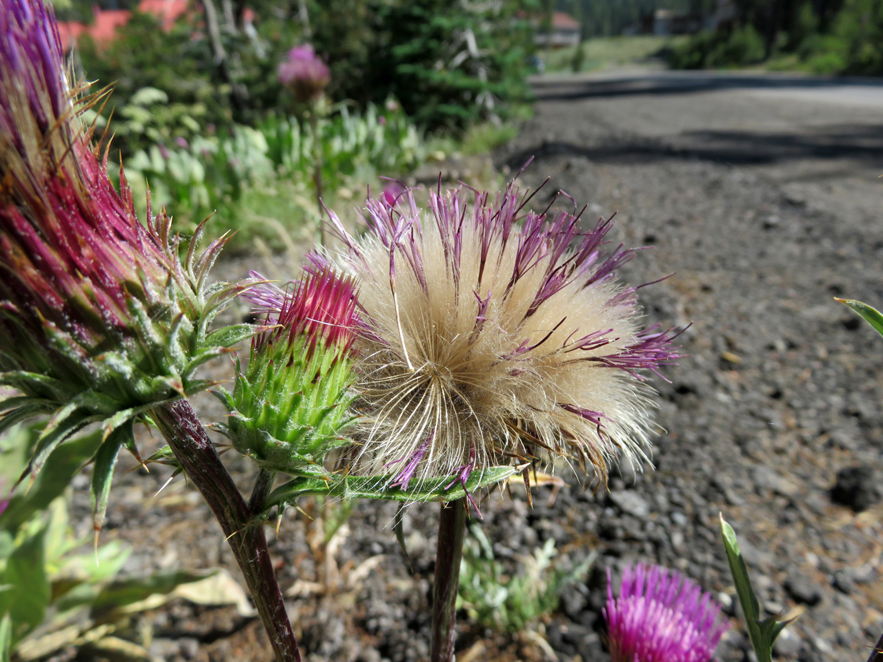
Wildflowers everywhere, enough water that they can exuberate well beyond the level possible where we live.

IMG_3173

IMG_3296

IMG_3181

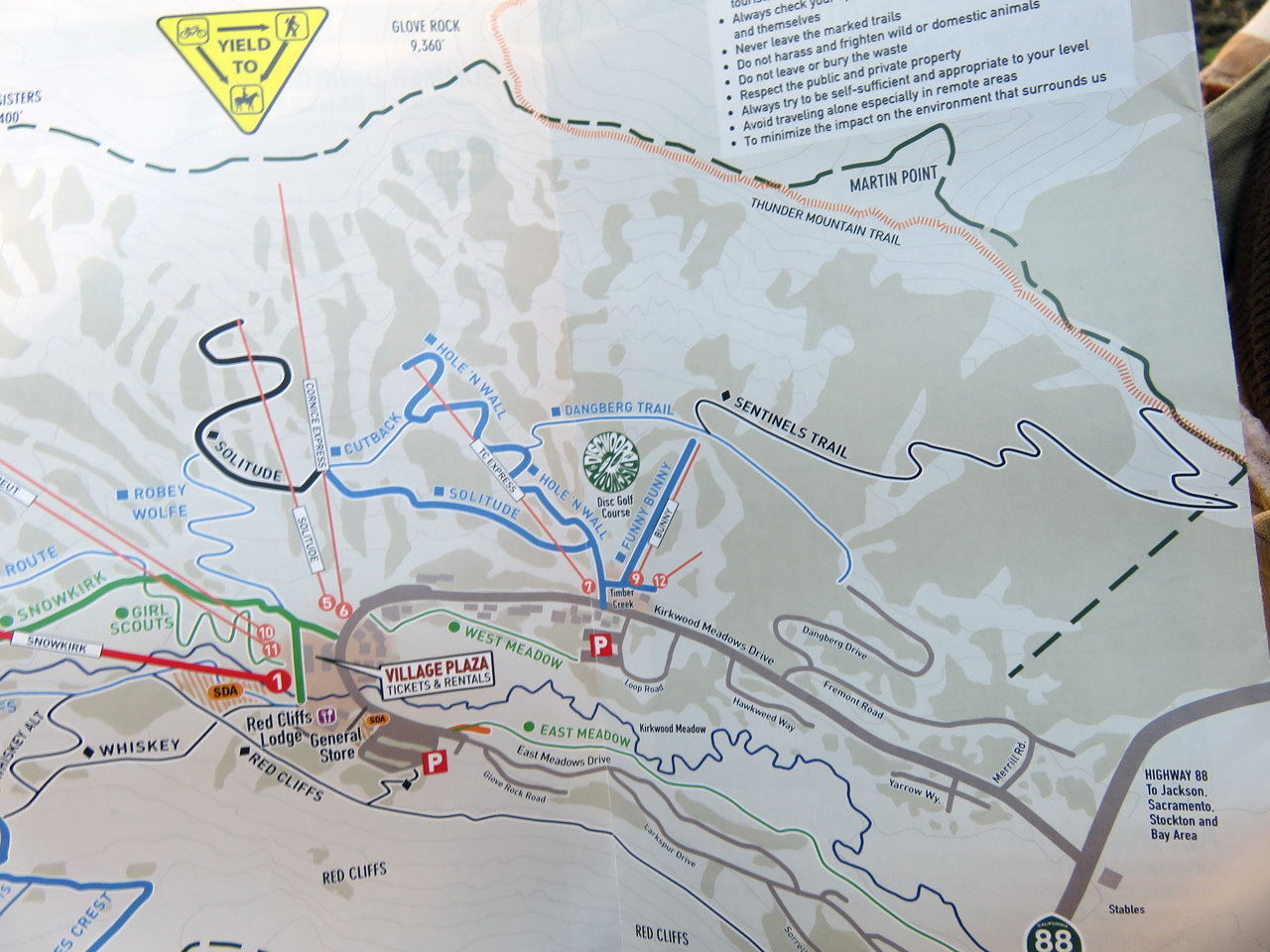
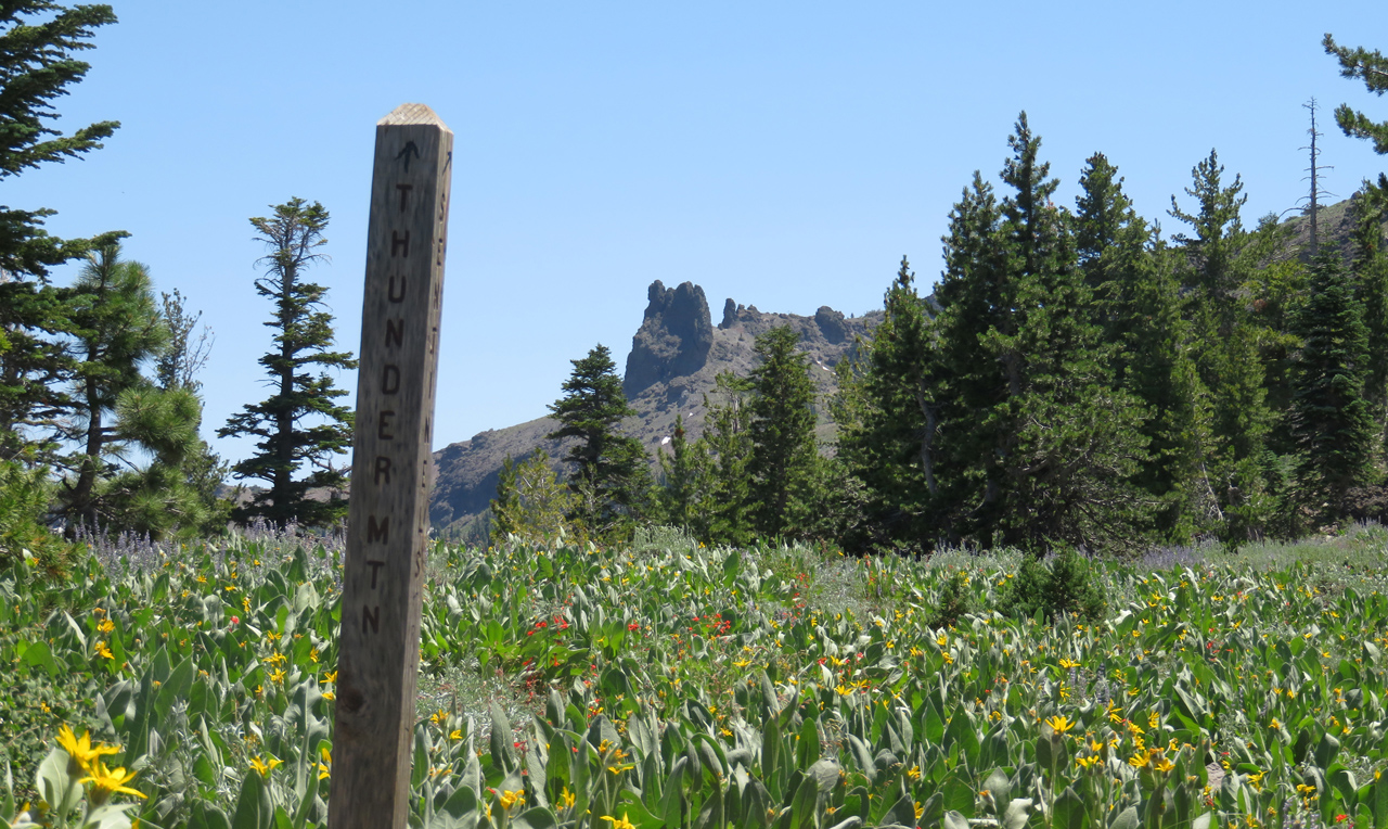
At the junction of Dangberg and Sentinels trails, we parted company. I wanted to do more work than did Jacky, so I hiked on up to the rim and some distance along it toward Thunder Mountain. Jacky continued on Dangberg trail.

IMG_3197

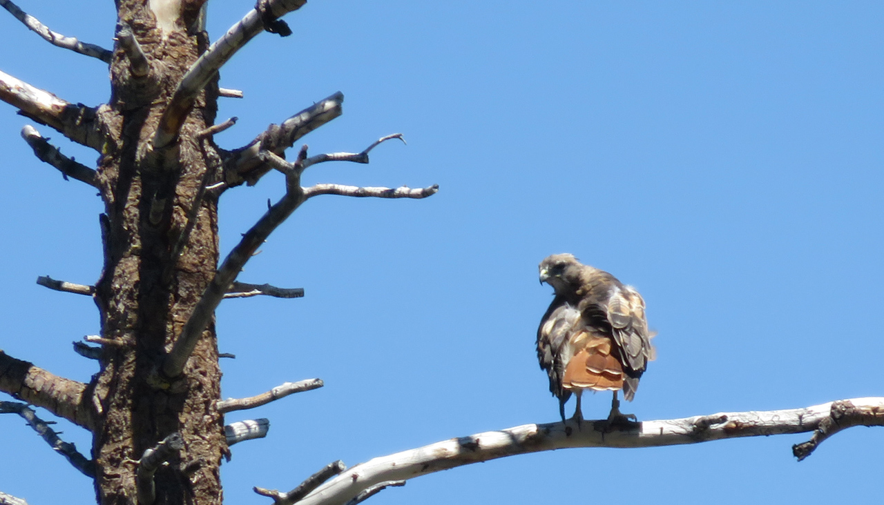
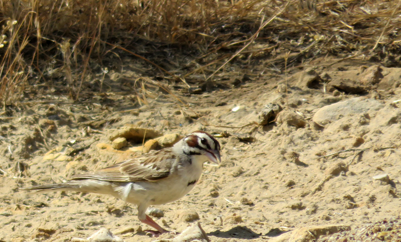
I heard a loud whoosh, and this guy passed within inches of my head, soared off into space, perched on this snag, turned its head back to look at me and ask, “What are you going to do about it?” Notice the band on its leg.

IMG_3218

A view from the top, showing pretty much all of Kirkwood Meadows. We’re staying in one of the buildings down there.

IMG_3221

Different angle from much the same vantage point, showing a sliver of Caples Lake and highway 88 as it comes down from there.

IMG_3226

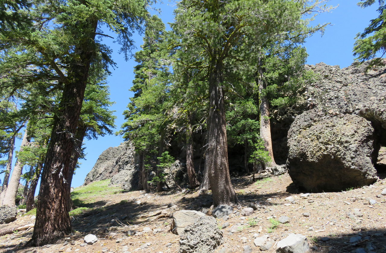
Yet a third view, yet further to the left, showing the exposed granite north of here. It is somewhat different geology; the local rock is lava, often containing embedded chunks of rock, which are themselves broken chunks of earlier lava flows.

IMG_3236

I presume that these two large rocks are the Sentinels for which the trail was named. The one on the right is visible from Kirkwood valley.

IMG_3241

Looking the other direction from the top of Sentinels trail. We’re near the tree line; much of what we see here is alpine meadow.

IMG_3271

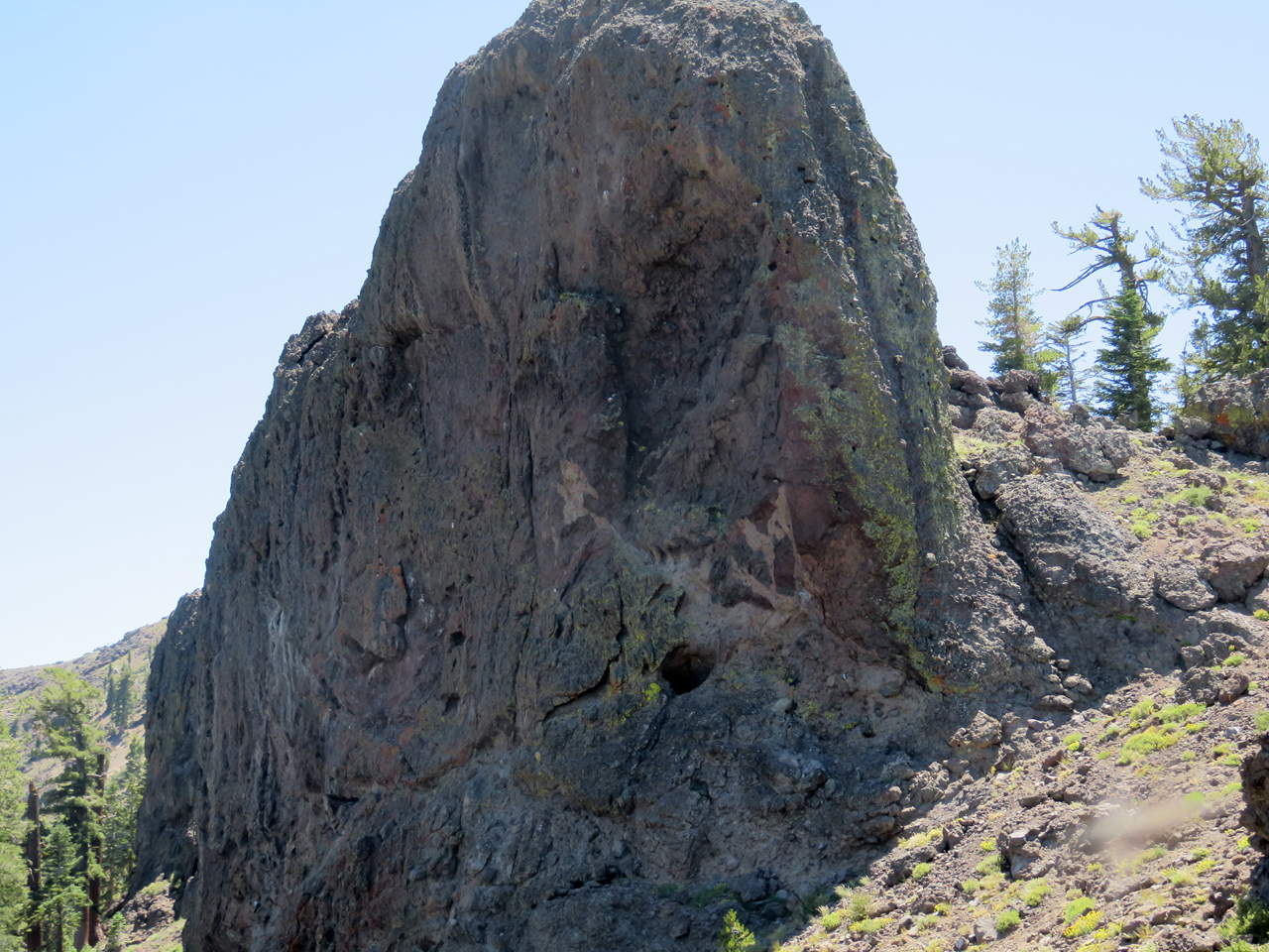
The flow of lava is clearly visible in this outcropping.

IMG_3274

At the top, and maybe in the depths of the ridge as well, the lava is a barrier only 20 or 100 feet thick; the trail runs below the crest, on the side away from Kirkwood valley. I thought there might be views of Silver Lake down the back side, but not from the part of the trail I hiked.

IMG_3281

I hiked into the trees at the top right of this picture, but declared victory before reaching the patch of snow. I have only one water bottle, it’s mid-afternoon, and I’m not entirely comfortable with an unfamiliar trail and a minimal to nonexistent map.

IMG_3285

Showing how thin the wall of lava rock is at the top.

IMG_3300

We usually don’t think of evergreen patterns as particularly artistic, but this one impressed me.

IMG_3304

Having already seen some of the distant views, I looked more closely at the wildflowers on the way down.

IMG_3310

IMG_3338

IMG_3344

IMG_3318

IMG_3360

Went back to the Resort office to see about getting checked in. We’re in a separate building several hundred feet away, a condo room that’s just fine — windows on two sides that can be opened to let in the overnight mountain air! Walked back to the general store for munchies, then returned to the lodge where we sat in the lobby and worked on photos and such.

Home tomorrow; nice to end the vacation on a high note. But no more three-week vacations: it’s just too long.


Dinosaurs

July 25, 2016

Monday, 25 July 2016

Up early, and ready to go. One good thing about this outdoors-oriented town is that the breakfast restaurants open at 6. We were on the road at 7. We had thought to go to Grand Junction today, but decided instead to stay on US 40 and go to Salt Lake City. Good choice: pretty grassland and forest scenery along the Yampa valley to start with, then getting into open plains, then into the eroded land near the Flaming Gorge, the Green, Yampa and Colorado rivers.

Our early adventure was successfully braking for a deer in the road, which was busy demonstrating why deer are poor life insurance risks.

IMG_3047

We stopped to enjoy blueberries and apples at a rest stop, quite different scenery to the west and to the east.

IMG_3050

IMG_3051

IMG_3053

A phallic close-up of the rock to the east.

IMG_3058

And the Jacky borrowed my camera and wasted a shot.

IMG_3064

A couple of little birds across the way, pecking for something yummy. No idea what they are.

Next stop was the Dinosaur National Monument gift shop, where we learned that the fossil exhibit was seven miles north of Jensen. Well, why not! (Why not could be that the entrance fee is $20 per car; but we have a parks pass, so that wasn’t a problem.)

IMG_3067

IMG_3077

IMG_3120

There is a large building over the site of many of the fossil excavations. In the beginning, they removed them and shipped them off to various universities and museums, but close to a hundred years ago, they decided it was best to leave the fossils in situ. And so they are.

IMG_3106

Two grad students were climbing around on the quarry, taking notes. The ranger said they were working on a Master’s project.

IMG_3130

Some of the fossils have been cast in plaster and are more easily seen.

IMG_3131

And models have been constructed for a few of them, too. The allosaurus is of course the favourite, as the biggest carnivore in the local menagerie.

Very hot day, so we didn’t go hiking, although there were plenty of trails. Drove on, enjoying a brief thunderstorm, until we reached I-80 east of Salt Lake. Slow (slow!) trucks making their way up the Wasatch grade on the east side, but on the west side, all of us, including the 18-wheelers, took it out of gear and let it roll. Speed limit 65, actuals up to about 80, except of course for the curves.

A little tricky finding our B&B, getting in, getting ensconced, but we did. Out for a beer and a meal, to Bayou, a nearby cajun restaurant. Pretty good, and only about three blocks. The heat was so uncomfortable that we didn’t go wandering, just headed back to the B&B to mellow out.


Steamboat

July 24, 2016

Sunday, 24 July 2016

IMG_2990

Allan, one half of our B&B hosting team, is pretty versatile. As well as having done some very impressive athletic things, he also sketched these, which adorn our room.

After yet another great breakfast, we said our good-byes and headed for LaGrange, Cheyenne, Laramie, where we stopped for gas and to get some blueberries and apples for later.

IMG_2998

Later turned out to be Walden, Colorado, where we sat in the grass on the courthouse lawn for munchies. Just across was the Pioneer Museum. Well, why not? The lady on duty told us it was bigger than it looked and she was right. Full basement, two second story sections, more stuff than you could imagine.

IMG_3000

An area of military gear, with rifles as its centerpiece.

IMG_3003

Forestry. Some of these are amazingly long, but when you think of the size of some of these trees, it’s clear that they have to use big saws to take them down.

IMG_3002

IMG_3004

IMG_3005

Moving away from outdoors violence, we see some telephone equipment.

IMG_3007

IMG_3009a

I hadn’t realized that Dodge has used the Ram symbol since forever, at least since 1936.

IMG_3009

IMG_3010

My mother had a sewing machine like this, except that the treadle mechanism had been retrofitted with an electric motor.

IMG_3011

Just outside Walden, a little nature stop, and a view of more poles than you could count. I thought they were destined as utility poles, until we saw something about material for log houses. Makes sense.

IMG_3016

Some little distance further on, a pull-out with a view of Rabbit-Ears Pass; then a long climb up there and a long descent down the other side into Steamboat Springs.

IMG_3029

We’re staying at the Bristol hotel, above. Nice enough, except that the rooms are very small. Left our things and went out to wander.

IMG_3024

The corner building is a drugstore, where Jacky stopped, while I went on to the second store, with the yellow sign. They had been advertising Lee and Levi jeans on their billboards for miles, as well as Stetson hats. Jacky thought I should get a Stetson.

IMG_3032

Well, certainly not Stetson boots. Does Stetson make boots?

IMG_3038

As to the hat, I don’t anticipate needing to give my horse a drink any time soon, so I skipped the hat. I was able to resist getting a classy western shirt, too.

IMG_3026

We found a place to enjoy a couple pints of stout in a shaded outdoor nook, wandered some more, napped in the hotel, went to Mahogany bar and grill, which was a definite disappointment.

Overall, that’s our reaction to Steamboat, too. When we were here a couple years ago, we liked Steamboat, tourist trap though it obviously was even then, but the appeal is less and less as time goes on. It is becoming so popular that its essence is disappearing. Aspenizing, should it be called, perhaps?

Scottsbluff, again

July 23, 2016

Saturday 23 July 2016

IMG_2940

There is a second museum here, the Farm and Ranch museum, FARM, so we stopped to see what there was to see. Much is under construction, not really advisable for unrestricted public access, but a pleasant young woman was kind enough to show us around.

IMG_2945

The first attraction is a house, donated by a local family and restored to authenticity as certified by the family itself. Not completely antique; the phone has a dial.

IMG_2946

Notice the heat exchanger atop the refrigerator. The range was electric, with coiled heater wires exposed in the grooves of the burners.

IMG_2947

IMG_2953

Outdoors, the first attraction is a jail cell, manufactured by a company in Detroit and available to those who might have need for such a thing. We presume it would normally be installed indoors somewhere.

IMG_2948

One of the larger of many tractors. The ambition is to restore as many machines as possible to working order, but it is a self-funded volunteer effort, so it’s completely open-ended.

IMG_2956

Not even sure what some of these things are.

IMG_2962

This one is a combine, actually never used, but donated by the manufacturer to the museum.

IMG_2965

There’s a big equipment shed, whose star attraction is arguably this big steam tractor. Our guide wasn’t sure this one would be possible to restore.

IMG_2966

The hearse is sometimes rented out, and not just for movies. Supply your own horses and enjoy a stylish final trip.

IMG_2968

IMG_2979

A kit tractor made by Ford, parts from model T or model A, our guide wasn’t sure which.

IMG_2982

A smaller steam tractor, with some of its gubbins, below.

IMG_2983

IMG_2986

IMG_2989

This is a bullboat, a buffalo hide stretched over a frame. Big enough for one trapper and his load or furs, or a smaller version big enough for the man and his gear but not a load of furs.

We went to Dorthey’s for lunch, but we supplied the lunch. We get far too few veggies on these trips, so we stopped at the grocery store and bought a package of broccoli slaw, some blackberries, and in a concession to the inevitable, fried chicken.

Then off to a tour of the new high school, under construction. They had only enough hard hats for half of those who signed up, and we were in the group that toured the existing high school under the guidance of the principal. My reaction was great relief that I will never again (I fervently hope) be associated with such a place. We bailed out after the first part and never did see the new construction.

After saying good-bye to Dorthey, we stopped at a liquor store for some porter, a couple of bottles of which we enjoyed on the balcony of the B&B. This evening, the formal reunion dinner at the Country Club, and tomorrow back on the road.

Scottsbluff

July 22, 2016

Friday 22 July 2016

Up at 5, out to the monument for a beautiful sunrise. We hiked all of the trails that were open from below and got back to the B&B in time for breakfast at 8.

IMG_2814

IMG_2830

IMG_2846

After breakfast, we stopped again at the monument, went through the visitor center and drove to the top. Very impressive 3D model of the terrain. The entire ridge was originally called Scotts Bluff, but the term now pertains only to the rock beyond Mitchell Pass, above the gap in the photo.

IMG_2915

In answer to my question: why did the pioneers come over the pass instead of going around the end, the answer is the extensive badlands below the bluff (the service road was built much later), and the quicksand further down into the North Platte flood plain.

IMG_2867

As to the rockslide that closed the trail, here it is. The signs warn about the upper surface having been undercut, so there could well be more risk than just loose rock fallen across the trail. We were able to hike only to a point on the near side roughly below where I stood to take the picture.

IMG_2919

I dropped Jacky off at Dorthey’s and went out to explore a little. High 90s again, so I’m not too ambitious, but then there’s not a lot to do around here anyway. Walked the main street of Scottsbluff, enjoying the uses to which the old theater has been put.

Jacky is completely down on Runzas, refuses to eat at Runza restaurants. So I tried one for lunch, just to form an independent judgement. It was okay, but we do a far better hamburger and cabbage pie ourselves at home. Not least because we would use red cabbage.

IMG_2926

Went to Lake Minatare, which has a lighthouse. No idea why. Tight spiral staircase to the top, where there is a view that’s pretty much the same as at the bottom. But it was something different to do.

Found a spot under an awning to read my book until the afternoon thunderstorm blew up. Rained pretty hard while I was in the car looking for trees to get under in case of hail. There were reports of big hail in the area, but none where I was. That’s fine with me.

IMG_2933

Back to Gering to pick up Jacky, and we went out to the reunion picnic, well out of town, but at a very nice meadow with a pretty pond.

IMG_2939

Of course, I didn’t know anyone, but several of the significant others banded together and talked about topics unrelated to the good old days. Probably upward of a hundred people, bluegrass band (without excessive amplification!), the usual picnic fare, and a good time was had by all.

Gering

July 21, 2016

Thursday, 21 July 2016

We did nothing much today, visited Dorthey, spent most of the afternoon in the air-conditioned library, took Dorthey to dinner at a godawful good-ole-boy restaurant that was just what she wanted. And escaped with our three remaining bottles of oatmeal porter to the deck on the back of the Barn Anew B&B, looking out at Mitchell Pass.

IMG_2742

While sitting there spoiled, what should my wondering eye behold but a fox. Don’t see many of those, at least not where we live! Cool!

IMG_2753

After doing our duty to the beer, we wandered the grounds of the B&B. We are the only guests tonight, as it happens.

IMG_2759

They have about four sheep wagons, at least two of which appear to have been fixed up such that they could be used for overflow guests. No plumbing, I suspect, so likely just a place to sleep.

IMG_2766

IMG_2763

And the head of a windmill. We don’t see those close-up very often.

IMG_2769

I think I mentioned that the B&B had been reconstructed from a barn. There was also a house that was in pretty bad shape. The house itself was demolished, except that its bay window has been turned around and now forms the backdrop for the weddings that are performed here. Nice.

IMG_2772

This the the old barn itself. We sat on the porch and watched the sunset.

IMG_2774

IMG_2791

The sprinklers were busy keeping the wedding venue green, and the spray in the sunset light was purely fortuitous.

IMG_2796

One of several cats came around to make friends, but when we didn’t pet it, it decided that a nap was the better part of valor. Agreed. Good night.

Making our way through the wilderness

July 21, 2016

Wednesday, 20 July 2016

Up early and out of our BnB (no breakfast: just a B, I guess) in Spearfish.

IMG_2321

Drove to Deadwood where we parked curbside, hoping to eat before the parking meter enforcement began. No problem. Pricey breakfast in Bullies hotel and casino, and we headed on south on the scenic route.

IMG_2334

Next stop was two or three points around Pactola reservoir, surrounded by pine forest, with a few boaters already out on the water. Pleasant place.

IMG_2352

Then a quick stop at Hill City to enjoy the trains. Big crowd already lined up waiting for the train ride in an hour. We don’t see any point in that kind of thing, but it’s fun to wander around and look at the  big machines.

IMG_2362

IMG_2368

IMG_2374

IMG_2382

Further south, the map showed Cascade Spring and Falls as notable roadside stops. We didn’t stay long at the spring; signs warned of poison ivy right at the picnic area and more down along the water, and we believed them. Not the kind of adventure we need today.

IMG_2387

IMG_2430

But we stopped longer at the Fall, a distinctly optimistic description of a few vertical feet of rapids. Pretty place.

IMG_2425

I like to view the texture in fast-flowing water by setting the shortest exposure possible.

IMG_2438

A family was there, also enjoying the water.

IMG_2443

IMG_2448

Much of the Black Hills region is quite pretty, but as we got further south and into Nebraska, we got more into the long stretches of rolling grassland that don’t have much to offer. Stopped briefly in Crawford, where we talked with an Information volunteer for a few minutes, and then we went on to Fort Robinson.

IMG_2463

The fort is back into the pretty country, probably as much because of water as anything else. Cavalry and infantry, late 19th century. Brick buildings, many of them, some adobe, some wood-frame. Big (big!) stables, as would be expected for a cavalry base.

IMG_2512

And stagecoach rides. The employee hitched up the team while we watched, and drove the coach out. The girl got to sit up top with him, and on the way back, she got to drive.

And then, more long miles in the hot, until we reached Agate Fossil Beds national monument.

IMG_2544

IMG_2593

Above the visitor center is a trail to a couple of the hills where the big finds originated. We hiked up in hundred-degree heat, glad that it crossed the green of the Niobrara river flood plain, and that the total loop was only a couple of miles.

IMG_2602

When seeing the name, I have always wondered why agate geology and fossils were compatible. Turns out they are not, of course. The ranch was called Agate Springs ranch because of what’s called moss agate found in the springs here, and the spring got lost from the subsequent name. No quartz around here anywhere.

IMG_2657

Gazillions of insects along the trail, mostly grasshoppers, but also those who are happy to prey on grasshoppers.

IMG_2664

Even grasshoppers can be interesting sometimes.

IMG_2673

IMG_2682

IMG_2716

I think this little guy is a robber fly.

Getting on in the afternoon, and we need to find our BnB in Scottsbluff.

IMG_2725

Scott’s Bluff is the left end of this ridge, and Mitchell Pass is the low point between. Why, we ask, did the pioneers not just go around the end of the ridge, rather than climbing the pass? Good question. Apparently the badlands and muddy terrain along the North Platte flood plain were more difficult than the pass. (But Google Earth shows that the railroad builders went level along the river instead of winding back and forth up the grade.)

Our B&B is the Barn Anew, an old horse barn (percherons: big rooms on the ground floor!) that has been rebuilt for lodging. We’re told that the framing is original, but I imagine that the rest of it was reconstructed. Picturesque.

Into Gering for an evening with Dorthey, another long day, happy to be out of the car.

California snobs

July 19, 2016

Tuesday, 19 July 2016

We drove north out of Casper to Buffalo, where we stopped and wandered around for a few minutes, then turned east on I-90 toward South Dakota. We had talked about going to Rapid City today, but decided to make today a bit shorter and do some extra miles tomorrow. So I reserved an airBnB in Spearfish. To avoid arriving too early, we overshot Spearfish on our way into the area, went to Sturgis, the home of the world’s largest motorcycle rally, the first week in August.

IMG_2237

IMG_2228

I got a Sturgis baseball cap for $5, a good price, considering that they usually sell for $20 and sometimes as much as $30. Mine always get sweaty and sun-bleached, so I always need more. And for that price, I don’t mind advertising Sturgis.

IMG_2219

It’s nice of them to invite me to enjoy the dog water, but I think I’ll pass, thank you very much.

IMG_2226

IMG_2243

If any further evidence is needed that it’s a motorcyclist’s town ….

We drove on to Deadwood, but decided, rather than spending the afternoon wandering Deadwood’s tourist attractions, we’d go visit Spearfish Canyon, a highly recommended byway. And it was well worth the visit!

IMG_2246

We took a brief hike above this stream, but turned back when the trail got steep enough that returning downhill would become difficult.

IMG_2256

According to the description, some of these cliffs above the road are as high as a thousand feet.

IMG_2270

IMG_2300

Just as we began to think we were not going to get our promised waterfall, we came to Bridal Veil fall. Yes, I know, this is a poor imitation of the one in Yosemite, but still, pretty nice.

IMG_2305

IMG_2312

On into Spearfish, where it turned out that we couldn’t get into the B&B; the allegedly unlocked door was snap-locked. We perched on the porch until Chad came home, riding up on his mountain bike. Nice place.

Of course, we immediately went out again, wandered a bit until we came to the Bay Leaf Cafe, which caters to yuppie tastes. We thought it might also have good brews, and indeed it did. They had Moose Drool, which we skipped this time, because we already know it’s good. Jacky had A Pile of Dirt (locally brewed porter) and I had a pint of Buffalo Sweat (oatmeal stout). Pretty good, along with our seafood dinners and decadent desserts.

IMG_2316

The official pictorial emblem of Spearfish suggests a catfish (whiskers), but this model looks more like a trout. Hard to say.

We wandered off to find a drugstore after dinner, then returned on the rec trail along the creek. Nice town.

Casper, Wy

July 18, 2016

Monday, 18 July 2016

Nice breakfast with our airBnB hostess. We thought we’d go out Logan Canyon, maybe stop to see some sights or even do a bit of a hike. But at the edge of town, a sign said the road was closed. Not the kind of adventure we’re looking for today, so we went south, back to the freeways, through Ogden and onto I-80 to and through Wyoming.

IMG_2187

Not that our choice turned out to be the worst scenery in the world. This picture is from a rest stop. Not too bad.

Wyoming has everything from desolate desert to red lumpy rock to white strata to varicolored strata. Much of it was very pretty. We crossed the continental divide at least four times, at elevations near 7000 feet. Oh, yes, and Wyoming has wind. Real, heavy-duty industrial-grade wind.

We had thought to go to Casper, but the intended route was 380 miles, and we weren’t sure we wanted to put in that many miles. But if we can’t hike Logan Canyon, maybe it’s doable after all. As it happened, the backtracked route we took was about 450 miles, so it was a long and tiring day. At least the traffic was okay, and we didn’t get delayed noticeably by road construction.

We stopped somewhere — Rock Springs, maybe? — at a Subway for lunchies. We like this chain: fast, inexpensive, and healthier options than the burger joints.

IMG_2192

We stopped on highway 220 at the Independence Rock site; so called because the first pioneers came past here on July 4. (I wondered whether pioneers are nuclear physicists who specialize in pions. Jacky thinks I was being frivolous.)

IMG_2203

While Jacky drove, I tried airBnB for options. We could have stayed the night in a sheep wagon, or a Minibago, or a $330 private room, or maybe in Douglas, Wyoming. So we checked into a La Quinta motel instead. Poor choice; not something to do again.

Wandered into town, mostly along a rec trail that runs along the North Platte river, full of more water than I would have expected. Walked up one street, down the next, almost ready to give up on anything worthwhile, when we spotted The WonderBar Brewery. Ok, Casper is not a dead loss; it has one redeeming virtue. A pretty good homebrewed porter. We ordered potato skins and barbecued ribs to share. Big dish of ribs shows up, I take half of the considerable visible amount, then discover they are layered two deep. We did what we could.

We had seen a sign that warned of high fire danger until 8 this evening. What !? But the seriously vicious wind began to die down as the sun sank, so I guess they know whereof they speak. And actually, the vicious wind was rather pleasant, once in a while, as long as the air is warm and not full of dust and grit. The kind of thing we don’t get very often at home.

Tomorrow: South Dakota?

Logan, Utah

July 17, 2016

Sunday, 17 July 2016

IMG_2154

Above, our home from home in Boise, an apartment above a garage, a shady yard well suited for a brew. A good experience.

It was about 8 by the time we rolled out of Boise. Freeway speed limit is 80 here, which is about as much as this little Kia Soul is comfortable with. Some dry desert country, but a lot of really pretty scenery along the Snake River valley. Irrigation monsters everywhere. UPDATE: Wind was the problem. On a subsequent day without gusty cross-winds, the car was just fine at 80.

IMG_2158

We have no desire for marathon days on the road; 250 or 300 miles is plenty long enough, thank you. We didn’t really stop until we reached Tremonton, whose one claim to fame, I guess, is the mural above. We wandered a few minutes, got back in the car and came on to Logan, a pleasant town we visited before under quite different circumstances.

Left the car and walked some more. Sunday is not the day to come to Utah; lots of things closed, pretty much no one on the streets.

IMG_2159

I’m not really up on my religious mythology, but I think Zion may not mean the same thing to Mormons as it does to Jews. But don’t quote me.

IMG_2164

A Mormon town, though, and no mistake. This is the tabernacle.

IMG_2172

And standing on a hill above the town, this is the temple. What’s the difference, you ask? And so did we. Well, there are very few tabernacles; apparently they are no longer being constructed or consecrated, but the great unwashed are welcome in tabernacles. Temples are only open to those who follow the Way. No idea whether there is a certification of some kind that you need to produce to get past the temple gates.

IMG_2185

Missionary attire? That kind of town. Not a lot of graffiti here, as you might expect.

IMG_2160

Otherwise, it’s a nice enough little place, or would be if everything were open, if the sidewalks were crowded with people making their way past those sitting at sidewalk tables enjoying the day.

IMG_2181

One thing you can say about Mormons: they are not big on poverty. And good for them.

IMG_2179

For those who are old enough to understand this, it’s highly apropos!

We discovered that my smartphone is prepared to give voice directions to navigate via GPS (most places I go, I don’t need directions, so never had occasion to find out!). Very handy; thank you Mr Android and Mr Samsung and Mr whoever.

From the B&B, we wandered out again, looking for something to eat. The fast-food places are open; there’s Denny’s and Sizzler and … and we ended up at The Old Bull (El Toro Viejo) for more Mex than we could have eaten in two days. Pretty good.

Boise

July 16, 2016

Saturday, 16 July 2016

Boise lies in the flat country just west of the mountains. A little online exploration reveals that there are no end of trails nearby, most of them in the mountains. The Table Rock loop sorted to the top of the list, and seems to be pretty interesting, so that’s where we went today. Parking at the old Penitentiary.

Which reminds me … what a misnomer that is! Had this truly been a home for penitents, it would not have needed guards or locks. It might have been called a monastery. The current equivalent is correctional institute, equally a misnomer.

IMG_1939

There were no paper maps, but the kiosk at the trailhead showed the options. Pretty simple; we took trail 15A up, went around the hill on 16, and came back down 15.

IMG_1940

There was a volunteer crew busy uprooting weeds. I thanked them for the effort. Always makes me feel good when I’m in their shoes and someone thanks me.

IMG_1957

The whole area burned recently. Long enough ago that it only weakly smells of smoke, but not very attractive.

IMG_1955

It was great to see the vegetation beginning to come back. For example, this green grass shooting out from the lump of burned grass.

IMG_1963

IMG_2013

The photo above came from the non-burned area, just to show what the single orphan flower further up will look like if it has a chance to mature.

IMG_1968

IMG_1965

Once we finally topped out and had a wide view further east, we could see the extent of the burn area, looking for all the world like cloud shadow.

IMG_1971

It’s called table rock because it was once the sedimentary solid floor of a lake, now elevated a couple thousand feet above the surroundings.

Up here at the top, a man with a dog. The dog running around, full of energy, full of life, full of joy. It had three legs.

IMG_1980

IMG_2009

There are communications antennas up here, consequently a road. But only a few cars; most people walked up and back down.

IMG_2001

IMG_2005

One of the bikies was a woman, who walked most of the way down, not confident in her brakes. The other bikie was a guy who rode the whole way. Not far from the bottom, and just ahead of us, he hit a rock the wrong way and took a spectacular fall. Not hurt beyond the usual scrapes, which is good.

IMG_2015

We found a shady picnic table outside the walls of the old penitentiary and enjoyed the views of the warden’s house and the bishop’s house while we munched our apples. Didn’t sign up for the penitentiary tour itself; we’d rather spend the time at the botanical garden.

IMG_2053

And so we did. It’s just outside the penitentiary walls itself, so we saw some of the outside.

IMG_2056

IMG_2081

I loosed off a raft of shots at this dragonfly, and am delighted that a couple of them turned out well. They clearly show that the leading edges of the wings are open.

IMG_2150

IMG_2096

Well, the botanical garden was very much worth the time, and I have a boatload of photos. But I won’t bore you with more than just a few.

IMG_2116

IMG_2036

IMG_2125

IMG_2129

There was a little creek, possibly with pumped recirculating water, covered with water striders. Cool!

IMG_2131

Back to the B&B for naps, then laundry, then a cool beer in the back yard, then to a middle eastern restaurant for goodies.

Nice day. Tomorrow, Logan, Utah.

Boise

July 15, 2016

Friday, 15 July 2016

Almost every business in Nevada has some kind of gambling. The motel restaurant was on the far side of the casino. Breakfast was good and  very inexpensive; they figure the Scylla-Charybdis ordeal of the slot machines will make up the difference. Not for us, but thank you for the exceptional food value, anyway.

We took highway 95 north out of Winnemucca, a road that runs absolutely straight as far as the eye can see, until it needs to go over the low pass between a pair of mountain ranges. Then it jogs a little, comes down the other side and makes a beeline for the next pass. If the phrase basin and range didn’t already exist to describe this country, it would have to be invented.

Deadly dull, most of it. Sagebrush. Further north, we get into the volcanic lava flow, presumably from the Yellowstone caldera, which is phenomenally ugly where it is exposed at the surface.

Eventually, we got to the junction with highway 78 in Oregon, and turned east. Almost immediately the country got better. There is still a thin layer of hard volcanic capstone, but it has collapsed in many places, exposing sedimentary underlayers that have eroded into pretty formations.

IMG_1841

These are called the Roman columns, naturally located at Rome, Oregon.

But the pretty sedimentary formations don’t last long, either, and we’re back to dreary scrub desert. Better as we approached the Snake river, at Marsing, where we pulled off for a very welcome look at water, grass, trees. Wonderful!

IMG_1842

IMG_1864

IMG_1878

IMG_1876

Suitably refreshed, we went on into Boise. It was only within the last ten years or so that I realized what the name of this town really is; having lost the accent off the trailing e, and anglicized its pronunciation, it was not as obvious as it certainly ought to have been. Better late than never: now we often pronounce it the French way, just for grins.

Found our airBnB without a whole lot of trouble. Our hostess is away at the Grands Tetons today, so we’ll meet her tomorrow. No worries; we dropped off our things and went out to explore.

IMG_1895

IMG_1899

IMG_1902

IMG_1911

IMG_1916

IMG_1924

IMG_1929

IMG_1933

Found the Double Tap pub, where I enjoyed a Moose Drool and Jacky found a porter that she liked.

IMG_1910

Then we walked back over to this building, which houses an Indian restaurant. Spoiled again.

On the way back to the BnB, we stopped at an Albertson’s grocery — turns out to be the same site as the first supermarket opened by Mr Albertson in 1939 — and bought breakfast fixings. Saves us some money and will be healthier and very likely better too.

Big Trees and Ebbetts Pass

July 14, 2016

Thursday, 14 July 2016

Big breakfast at Hillbillies restaurant, Murphys. Then we headed on up highway 4. First stop, Calaveras Big Trees state park.

IMG_1702

We have been here before, of course, but not for a long time. Pretty classy.

IMG_1710

IMG_1712

IMG_1727

IMG_1738

IMG_1747

IMG_1751

IMG_1766

Not everything here is gigantic. By the way, the understory is mostly dogwood. We need to come back here some time when it’s in full bloom; it must be spectacular.

IMG_1773

IMG_1774

IMG_1779

IMG_1783

IMG_1785

Cyclists heading uphill, most likely training for the Markleeville Death Ride. Good to see them out. The road is wide and good as far as the ski areas, then becomes challenging. Good pavement, but too narrow for a center line, sharp, blind curves, steep grades. We stopped several times for scenery breaks, but were happy when we bottomed out along the east fork Carson river going into Markleeville.

IMG_1795

IMG_1801

IMG_1817

IMG_1821

IMG_1835

IMG_1837

From the junction with highway 88 north of Markleeville, we took the same route that we rode on our trans-continental bicycle tour, through Fallon and then to Winnemucca. Found a motel and dumped our stuff.

Very hot day, but of course we went out looking for a brew and a meal. Maps on our smartphones are not very helpful, but we did find a cool quiet place for a couple of beers — then saw another couple places later on. We decided on Martin’s Hotel, a basque restaurant. You order your own entree, but the rest is family style. We shared a long table with a couple from Hanford Ca, and three from near Tampa. Good food, nice to talk with some new people.

The Mother Lode

July 13, 2016

Wednesday, 13 July 2016

We’re off! Also, we got started on a vacation trip to Nebraska. Go figure! (Maybe that proves that we’re off.) I just signed up with AirBnB, and our first experience will be tonight in Murphys. The software is a bit flaky, but we hope the room isn’t.

IMG_1433

First sight to see was the wizard of Oakdale. And we know nothing more than what you see right here, so don’t ask.

IMG_1451

The water tower from Petticoat Junction. In fact, we are at Railtown, the museum at Jamestown. We’ve been here before, but not for quite a number of years, so it’s nearly new. We aren’t much interested in train rides, especially behind today’s Diesel offering, but of course signed up for the guided tour of the roundhouse.

IMG_1464

IMG_1480

Of course, Shays are the most interesting Loks of all, because you can see all the gubbins doing their gubbing. Also because they are the real workhorses of rough country, grades, agility, anything you want, except speed. Max is about 15 mph, with a brave engineer. Our guide says they shed parts; whenever they take this one out for a run, they have a patrol to sweep the route afterward to collect the bits and pieces that get left behind. Great toys!

IMG_1493

IMG_1494

IMG_1501

One of the guys on the tour was a volunteer at another rail museum, and was kind enough to explain the speed and reversing mechanism in terms that pretty much most of us could understand. I even mostly understood it myself.

IMG_1507

This was another interesting artifact. It’s called a blind driver, a drive wheel without a flange. It rides between fore and aft flanged wheels, and cannot have a flange itself because it has to mediate between its neighbors on curves. I don’t think I knew about these before.

IMG_1513

The wheels themselves are cast iron, too soft and brittle to stand up to the load, so they have tires. Above, a tire ring, a loop of gas jets that heats the tire red hot, which causes it to expand enough that it can be slipped over a cast iron base wheel. The tire can be machined down a few times as it wears, and is eventually replaced with another. Replacing a tire was a good job to complete just at quitting time, so things would be cool enough to work with come next morning.

IMG_1517

To ferry VIPs to the Hetch Hetchy dam construction site, this White truck was turned into a rail vehicle. A couple of interesting things: behind the cowcatcher and between the leaf springs is the crank start. That must have been tricky.

The steering wheel remains in place, because the throttle and such were mounted on the steering column. So they adapted the wheel to apply the front brakes.

But most interesting of all is the square frame visible midships below the vehicle. It could be put down onto the rails. The vehicle was jacked up so that the wheels cleared the rails, and spun around to go back the other direction. A built-in turntable!

IMG_1549

As well as bits and pieces for the Loks, they made tools here. A complete machine shop, and with overhead shaft power. Unfortunately, the buildings have shifted to be out of true, so the shafts cannot safely be run today.

IMG_1548

Some of the pulleys are wooden laminates.

IMG_1554

The roundhouse was round, of course, because it at least partially surrounded a turntable.

IMG_1560

The turntable is (now) driven by compressed air.

It wasn’t so hard to turn the table, but stopping a swinging Lok required finesse as well as brute force.

IMG_1563

I liked the little locking slider here.

IMG_1577

These artifacts have a long and colourful history in the movies. Several of the Loks and cars are half length, which was convenient on tight mountain turns, but also in wide-angle views of trains in western movies, where pretty much no one ever notices.

IMG_1578

Smokestack cosmetics, to make the Loks look like whatever they wanted. By the way, westerns typically show the tenders piled high with firewood, but wood hasn’t been used for two hundred years. All of these Loks burn oil, even during their stints in the movies.

IMG_1585

The freight room; I especially like the good-sized crate containing an Underwood typewriter.

Enough! We went on to Columbia, a state historic park. Real gold rush history here, a place where the placer washes undermined the houses of the town; not a problem, houses can be rebuilt.

IMG_1594

Popular and picturesque place.

IMG_1606

We saw serious industrial blacksmithing this morning. Here’s the other side of the coin, the smith busy at work making ornamental horseshoes and other tourist merchandise.

IMG_1611

IMG_1615

Time for lunch, enough that we really weren’t hungry this evening.

IMG_1638

A real Wells-Fargo office. Their scale was accurate enough to weigh the signature in pencil on a piece of paper.

IMG_1647

And real horses. Not sure how much of the rest is real, but it’s a good time for all.

IMG_1648

And panning for gold is probably a good lesson in how dirty, thankless and unprofitable most miners discovered their lives to be.

Enough! Time to go to Murphys. Parrot’s Ferry road is a good route. I had this road in mind some years ago when I took Wards Ferry road into Sonora from the south. The worst drive I ever had in my life. Steep grades, vertical on both sides, less than one lane wide in many places. Well, today was much better.

IMG_1660

IMG_1662

IMG_1666

Murphys’ unique claim to fame is its E Clampus Vitus wall of comparative ovations. Sometimes humorous, but always on point.

IMG_1673

Sir Francis Drake, above, not eligible to be a Clamper because of a tendency to piracy (an understatement), being presented with a fish by Hi-Ho the Indian.

IMG_1677

IMG_1683

The Lok driver, alleged to be the only teetotal Clamper, a scurrilous rumour that was found to be untrue.

IMG_1694

And down the street is the Pourhouse (great name!), with a plaque for Michelson (think Michelson-Morley experiment) at curbside.

We went out to check in at the BnB (no breakfast; does that just make it a B?), have a nap, and mellow out. Walked back into town, enjoyed a couple of dark brews at the Pourhouse.

IMG_1698

If we lived here, this might go far to becoming our Local.

Busy day. Good day. Good night.